
Page 2 - Aerial Mapping
P. 2
AERIAL MAPPING The excellence of collaboration
The COMPANY
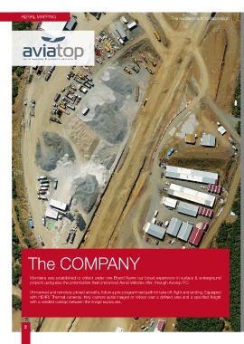
Moniterra was established to collect under one Brand Name our broad experience in surface & underground
projects using also the potentialities that Unmanned Aerial Vehicles offer, through Aviatop P.C.
Unmanned and remotely-piloted aircrafts, follow a pre-programmed path for take off, flight and landing. Equipped
with HD/IR/ Thermal cameras, they capture aerial images or videos over a defined area and a specified height
with a needed overlap between the image exposures.
2