
Page 7 - Aerial Mapping
P. 7
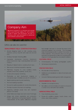
www.moniterra.engineering                                                              AERIAL MAPPING


             Company Aim


             Moniterra’s prospect is to introduce and expand
             UAVs export through Aviatop P.C. with business
             results in Greece and Worldwide, and also to
             introduce other uses and benefits of unmanned
             aerial vehicles business areas.


        UAVs can also be used for:


        DEVELOPMENT FIELD- CONSTRUCTION FIELD                     field strength and uses to calculate the nature of the
                                                                  underlying magnetic rock structure.  This knowledge
        •   General Mapping based on GIS. Updating areas,         helps trained geophysicists to predict the location of
            improves currency map info with lower cost and less   mineral deposits. The production side of oil and gas
            time.
                                                                  exploration and production entails the monitoring of the
        •   Building Information Modeling (BIM).                  integrity of oil and gas pipelines and related installation.
        •   Exploration  -  Assessment  -  Inventory.    Assessment   CULTURAL FIELD
            before investments help in planning better and avoid
            conflicts.                                         •   Cinematography - film making - photography - sports.
                                                               •   Archeological assessments.
        •   Mapping of natural features. Updating flood maps.

        •   Site surveys including topographic mapping.
                                                               PROTECTION FIELD
        •   Preliminary mapping for route locations (roads,
            railroads, power lines, pipelines, canals, etc.).  •   Fire detection & flood detection.
                                                               •   Assistance and remediation on time of hurricanes and
        •   Construction progress monitoring.
                                                                  earthquakes.
        •   Real-estate or land development mapping at
            conceptual stage to develop accurate 3D simulations.  •   Domestic Policing, boarding patrol, traffic management.

        •   Spatial planning; planning and monitoring.
                                                               ENVIRONMENTAL FIELD
        •   Roof and building inspection.
                                                               •   Plantation and animal Inventory.
        •   Surveys for quality assurance for construction projects.
                                                               •   Surveillance and determination of volumes removed in
        •   Provides important information for buildings.         a surface mine, stockpiles and materials.

        •   Inspecting overhead power lines with maximum
            precision and safety.                              AGRICULTURAL FIELD

        •   Detect failures as bridge crack (even under the bridge).  •   Crop monitoring, spray crops.
        •   Oil/gas and mineral exploration and production.    •   Scouts for problems (weeds, insects stress, crop
            Perform geophysical surveys/geomagnetic surveys,      stress, water stress, barriers).
            measurements  of the earth’s differential magnetic


                                                                                                              7