
Page 3 - Aerial Mapping
P. 3
www.moniterra.engineering AERIAL MAPPING
COMPANY’S EXPERIENCE
• Over 120 km of highway construction monitoring
• Corridor mapping and topographical survey
• Urban areas mapping
• Geotechnical and Structural Deformation Monitoring of
Grand Projects
• Surface Data Analysis
• Orthophotos
• Video Capture
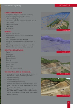
Image Capturing
BENEFITS
• Surveying cost reduction
• Impressive and persuasive way of presentations to
decision-makers
• Low mobilization of time and manpower
• Precise low-cost quantity surveys before tendering a
project
• Acknowledgment of environmental working conditions
• Full information even on areas difficult to approach
EXPORTS & DELIVERABLES
• Photos Mesh 3D Model
• Orthophotos
• Mesh 3D Models
• Texture 3D Models
• Drawings
• Videos- Presentations
• Contour Maps
• Slope Maps
• Area- Volumetric calculations
THE RESULTING DATA IS USEFUL FOR:
1. Topographical surveying, particularly in remote or Texture 3D Model
difficult areas, in mining and dredging industries.
2. Vegetation monitoring
3. Infrastructure mapping
4. Construction progress monitoring
5. Inspection and detection of issues which might occur
during the project due to the bad weather conditions
(floods, strong wind, etc)
6. Calculate the nature of underlying magnetic rock
structure and help to predict locations of mined deposits
7. Take off and estimating volumes, areas, items before
and after the project.
Virtual Reality
3