
Page 14 - 2016_ERDAS_IMAGINE_BROCHURE_HexGeo_Print_Neat
P. 14
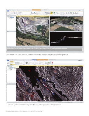
View and Edit LiDAR data as well as point clouds created in IMAGINE Photogrammetry and ImageStation.


          A full set of dynamic tools for working with radar data, including automatic change detection


        14 | ERDAS IMAGINE The world’s most widely-used remote sensing software package