
Page 6 - 2016_ERDAS_IMAGINE_BROCHURE_HexGeo_Print_Neat
P. 6
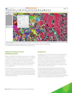
ERDAS IMAGINE provides more classification solutions than any other product on the market,
          including K-Means, ISODATA, and object-based segmentation.


          MAKE THE MOST OF YOUR                                  VERSATILE
          GEOSPATIAL DATA
                                                                 For organizations with extensive collections of geospatial data,
          Imagery and LiDAR are the primary sources of data for mapping   ERDAS IMAGINE supports enterprise-enabled geospatial
          and managing features or resources. Whether you are studying   image processing that utilizes a centralized relational
          changes in urban growth, sensitive environments, mapping   database to store geospatial information. This provides
          resources, or assessing damage from natural disasters, a   enormous benefit to an institution, making data visible and
          geospatial data archive enables you to reference and measure   accessible to end users through data management solutions
          the amount of change that has taken place in a geographic   such as ERDAS APOLLO. Existing and future investments in
          area. Accurate and up-to-date data leads to quicker, more    image and feature geospatial information are exploitable by the
          informed decisions.                                    greatest number of decision-makers.
          ERDAS IMAGINE unites users from different departments   As users upgrade their hardware and operating systems,
          within your organization, saving training time and increasing   ERDAS IMAGINE takes advantage of these new technologies
          productivity. Your co-workers, business partners, and clients can   through threading, parallel processing, and minimizing the
          now work on a project and produce consistent results through a   number of times the pixel is touched on the hard disk. Batch
                                                                                        ®
                                                                                                               ®
          single intuitive interface. You can also customize ERDAS IMAGINE   tools in IMAGINE Advantage  and IMAGINE Professional
          to simplify your workflows.                            enable multi-core and distributed processing jobs, allowing large
                                                                 projects to fully leverage system and network resources.


        6 | ERDAS IMAGINE The world’s most widely-used remote sensing software package