
Page 3 - 2018 GB Final
P. 3
The Story Of The Erie Canal
Completed in 1825, the Erie Canal was the engineering marvel of its time. The canal stretched across
New York State for 363 miles, and included 18 aqueducts bridging
rivers and ravines, and 83 locks used to raise and lower boats to
accommodate the 568-foot elevation change between the Hudson
River Valley and Lake Erie in Buffalo
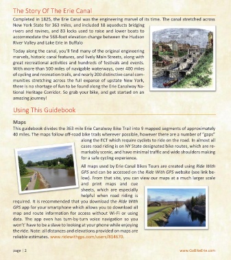
Today along the canal, you'll find many of the original engineering
marvels, historic canal features, and lively Main Streets, along with
great recreational activities and hundreds of festivals and events.
With more than 500 miles of navigable waterways, over 400 miles
of cycling and recreation trails, and nearly 200 distinctive canal com-
munities stretching across the full expanse of upstate New York,
there is no shortage of fun to be found along the Erie Canalway Na-
tional Heritage Corridor. So grab your bike, and get started on an
amazing journey!
Using This Guidebook
Maps
This guidebook divides the 363 mile Erie Canalway Bike Trail into 9 mapped segments of approximately
40 miles. The maps follow off-road bike trails wherever possible, however there are a number of “gaps”
along the ECT which require cyclists to ride on the road. In almost all
cases road riding is on NY State designated bike routes, which are re-
markably scenic, and have minimal traffic and wide shoulders making
for a safe cycling experience.
All maps used by Erie Canal Bikes Tours are created using Ride With
GPS and can be accessed on the Ride With GPS website (see link be-
low). From that site, you can view our maps at a much larger scale
and print maps and cue
sheets, which are especially
helpful when road riding is
required. It is recommended that you download the Ride With
GPS app for your smartphone which allows you to download all
map and route information for access without Wi-Fi or using
data. The app even has turn-by-turn voice navigation so you
won’t’ have to be a slave to looking at your phone while enjoying
the ride. Note: all distances and elevations provided on maps are
reliable estimates. www.ridewithgps.com/users/814670.
page | 2 www.GoBikeErie.com