
Page 6 - Railways
P. 6
RAILWAYS The excellence of collaboration www.moniterra.engineering RAILWAYS
PROJECT: “RENOVATION OF INFRASTRUCTURE – FOUNDATIONS
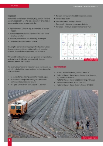
Inspection • The easy comparison of multiple inspection periods AND SUPPORT OF TUNNEL FROM OMONOIA TO MONASTIRAKI OF
Intact tunnel structures are necessary to guarantee safe and • The accurate results
economic operation, so what is a precondition to facilitate an • The monitoring of damage overtime THE ATHENS PIRAEUS ELECTRIC RAILWAYS S.A.”
economical life cycle management is the:
• The speed – minimum time presence in track
• The safety – minimum personnel presence in track
• Inspection of the tunnel on regular time basis, or after an 1. A FEW WORDS ABOUT THE PROJECT: network were made with a high precision 3cc geodetic station
incident The Athens Piraeus Electric Railways is one of the oldest Greek for angles and +/- 1mm+2ppm for distances. The polygonal
• Acknowledgement and documentation of current tunnel enterprises in operation (140 years) and its history is interlinked routings that followed were fully tied to the two ends of the
main horizontal network. The distances between the peaks
structure condition with the history of Greece over this period. were approximately 150 m. and less where deemed necessary.
• Allocation, classification and monitoring of damages The first railway was inaugurated in 1869, and, up to 1904, the Elevation Network: The primary and secondary elevation
• Data Base creation of tunnel’s condition Athens-Piraeus line was served by steam engines. After that, network was measured using geometric levelling with the
the trains were powered by electricity and the electric railways required precision. The new elevation network was also
were modernized. In the context of this modernization and the correlated with the existing level benchmarks of the sections
By using the same mobile mapping method as for envelope upgrade of the ISAP railways, a renovation of the infrastructure- on both sides at the ends of the Piraeus to Kifissia project
clearance, dense point cloud data is collected, exporting foundations, and the support of the Omonoia-Monastiraki (K.P. 0+050 – K.P. 25+600). With regard to the primary level
projected high definition images of the tunnel surface. tunnel started in 2008. network, fixed points were established throughout the length
of the entire Piraeus-Kifissia line outside the fencing, so that
With predefined tunnel structure and geometry of inspectables, 2. OUR CONTRIBUTION TO THE PROJECT: they were located outside the project’s zone of influence. The
distance between the established points was approximately
next step is the digitalization of recognizable damage, Inspection sheet The implementation of this project required constant surveying 400 meters. The Level Network was measured with digital
structural features & equipment. support, both before and after the start of construction. Our levels +/- 1 mm/Km.
contribution pertained to both these stages with corresponding Surveying
surveying works each time, for kilometre points from 0+650
The automatic generation of inspection result overviews is one EXPERIENCE (Neo Faliro Station) to 26+600 (Kifissia Station), as follows: The complete surveying of the existing condition of the railway
of the benefits that this non-conventional method offers. Also network (lines, surrounding space, stations, work lines,
to be mentioned: - DESIGN STUDY PHASE continuous welded rails, technical works, the positions of the
• Metro Line Rehabilitation, Athens GREECE • Establishment and resolution of primary and secondary cable troughs, manholes, existing utilities networks – operating
• National Railway Tunnel inspection and maintenance, horizontal and elevation control network. systems of ISAP S.A. overhead, electric joints etc.) was
• The comprehensive filtering routines for the data export Ag. Stefanos, GREECE • Horizontal and elevation surveying of the existing lines conducted using two methods:
• The standardized inspection catalogue vs inspector’s • National Railway Tunnel inspection Tempi, GREECE and the surrounding space, inside and outside the • Imaging with geodetic station Trimble S6 High Precision 1’’
preferences in symbols and textures • Railway Construction, Ikonio, GREECE tunnel, stations, and work lines. (1mm+1ppm).
• The Digital Tunnel archive book creation / Data Base • National Railway Cargo Station, Athens GREECE • Imaging of all survey data in drawings and digital format The general imaging of the railway network (except for the
(horizontal plans, longitudinal sections, cross-sections). tunnel), the stations, surrounding space, etc., was mainly
based there.
The already established fixed points of the trigonometrical
In more detail,
network were used for tying.
Establishment and resolution of primary and secondary • Surveying with the GRP 1000 railway track geometry
horizontal and elevation control network
control system, on which the detailed imaging of the tracks
The points of the two networks were tied to the State was based, and the GRP 5000 control system, which
Trigonometrical Network. consists of the GRP 1000, including a digital Amberg
Laser Scanner 5003. The latter was used especially for
Horizontal Network: For the primary horizontal network, two
fixed points were established on the exterior of each station, high precision surveying of points of the perimeter of the
tunnel and its clearance, as well as the drawing of the
so that they would not be affected by the construction works.
They were positioned at the start and end of each station cross sections.
and they were mutually visible. There was also densification The use of the GRP 1000-5000 became even more necessary
of fixed points between stations where deemed necessary. during the project’s construction phase, as will be seen below.
The measurements of the primary trigonometrical network of This system, operated by appropriately trained staff, is the ideal
the two peaks of each station were made with GPS and the instrument for survey works on railway projects, and especially
coordinates were entered into the Greek Geodetic Reference for projects that include such a long length of railway tracks,
System (EGSA) 87.
where the need to save time due to the strict deadlines and
- The secondary horizontal network was installed and marked for a quality result are very high. This system was used for this
permanently close to the working site. It consisted of points specific project, supported by geodetic Stations LEICA 1201,
of paired mutual visibility, and was connected with the basic 1’’,+/- (2mm+2ppm) , LEICA 2003, 0,5’’, +/- (1mm+1ppm) ,
trigonometrical network of the Hellenic Military Geographical and the Amberg Laser Scanner. The advantages of the GRP
Service. The measurements for the secondary horizontal 1000-5000 system are:
Ikonio cargo station
6 7