
Page 12 - Legal Aid CRP EJ Toolkit
P. 12
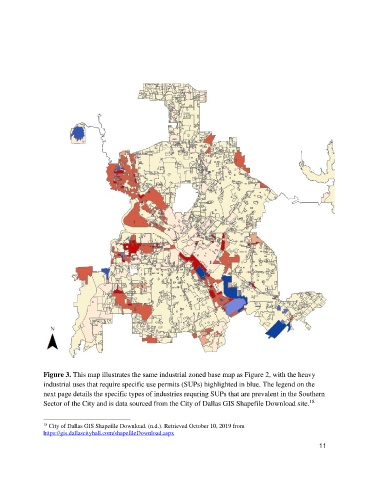
Figure 3. This map illustrates the same industrial zoned base map as Figure 2, with the heavy
               industrial uses that require specific use permits (SUPs) highlighted in blue. The legend on the
               next page details the specific types of industries requring SUPs that are prevalent in the Southern
                                                                                                       18
               Sector of the City and is data sourced from the City of Dallas GIS Shapefile Download site.


               18  City of Dallas GIS Shapefile Download. (n.d.). Retrieved October 10, 2019 from
               https://gis.dallascityhall.com/shapefileDownload.aspx
                                                                                                           11