
Page 15 - General Prospectus Web 2019 Jan 18
P. 15
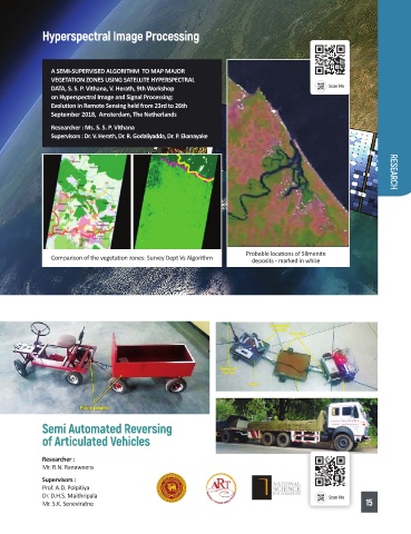
Hyperspectral Image Processing


              A SEMI-SUPERVISED ALGORITHM  TO MAP MAJOR
              VEGETATION ZONES USING SATELLITE HYPERSPECTRAL
              DATA, S. S. P. Vithana, V. Herath, 9th Workshop
              on Hyperspectral Image and Signal Processing:
              Evolution in Remote Sensing held from 23rd to 26th
              September 2018,  Amsterdam, The Netherlands
              Researcher : Ms. S. S. P. Vithana
              Supervisors : Dr. V. Herath, Dr. R. Godaliyadda, Dr. P. Ekanayake                      RESEARCH


                                                                Probable locations of SIlmenite
              Comparison of the vegetation zones: Survey Dept Vs Algorithm  deposits - marked in white


            Semi Automated Reversing
            of Articulated Vehicles

            Researcher :
            Mr. R.N. Ranaweera
            Supervisors :
            Prof. A.D. Polpitiya
            Dr. D.H.S. Maithripala
            Mr. S.K. Seneviratne                                                              15