
Page 18 - manual_V5_11_9_2018_Html5
P. 18
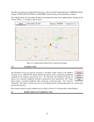
The Map Type drop-down menu allows the user to select from four background maps: TERRAIN (default
               setting); SATELLITE; ROADMAP; and HYBRID (satellite display with roads/names overlaid).

               Once changes in the text box and/or the drop-down menus have been made, apply them by clicking on the
               ‘Search’ button.  An example is shown below.


                                    Figure 2-2: Using the Map Display Tools to customize the display.
               2.4               Simulation Tools


               The Simulation Tools are used for executing a conceptual model created in the MDWA.
               Clicking the red ‘SIMULATE’ button initiates the process of the solving the groundwater
               equations for the domain created by the user.  The ‘Forward’ and ‘Backward’ buttons are
               used to run a transient simulation forward or backward in time, respectively. The ‘Pause’
               button  pauses  a  transient simulation  after solving  the  current time-step.   The  ‘Forward’,
               ‘Backward’, and ‘Pause’ buttons may also be used during particle tracking applications of a steady-state
               groundwater solution.

               More details related to model simulation are provided in Section 5.1 and elsewhere in this Manual.

               2.5               Model Creation and Visualization Tools


                                                             18