
Page 104 - eProceeding - IRSTC & RESPEX 2017
P. 104
Syamsul Anuar / JOJAPS – JOURNAL ONLINE JARINGAN COT POLIPD
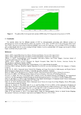
Figure 5: The path profile of photogrammetric product (DEM) using UAV images processing based on 5 GCPs
5. Conclusion
The analysis shows that the different number of GCP in photogrammetric processing give different accuracy in
photogrammetric results and automatically achieve the objective. In this study, 10 GCPs used in processing give better result
than 5 GCPs. However, it shows that the different in RMSE value is small. For small area, it has proved that 5 GCPs is enough to
give accurate height value for an area covering 0.10 km². Finally, it can be concluded that UAV images can be used for obtain
height coordinate and give good results.
References
Agisoft. (2013). Agisoft PhotoScan User Manual. Professional Edition, Version 1.0.0. Agisoft LLC.
Agisoft. (2012). Agisoft PhotoScan User Manual. Professional Edition, Version 0.9.0. Agisoft LLC.
Akkawi, E. (2013). Geomorphology Using Geographic Information System And Globel Mapper. American Journal of
Environmental Science 9 (5): 398-409, 2013
ASPRS. (2013). ASPRS Accuracy Standards for Digital Geospatial Data. Draft For Review, American Society for
Photogrammetry and Remote Sensing (ASPRS).
Global Mapper. (2014). Global Mapper Help. Global Mapper v15.2.3. Blue Marble Geographic.
Gatewing. (2012). Software Workflow AgiSoft PhotoScan Pro 0.9.0 For use with Gatewing X100 UAS. Belgium: A Trimble
Company.
Bailey, M., W. (2012). Unmanned Aerial Vehicle Path Planning and Image Processing for Orthoimagery and Digital Surface
Model Generation. Degree Master of Science. Vanderbilt University, Nashville, Tennessee.
Burns, R. (2006). Unit 9: Photogrammetry. Caltrans LS/LSIT Video Exam Preparation Course. Caltrans Geometronics.
Eisenbeiss, H. (2009). UAV Photogrammetry. Degree of Doctor of Science, University of Technology Dresden.
Evaraerts, J. (2008). The Use of Unmanned Aerial Vehicles (UAVs) For Remote Sensing And Mapping. The International
Archives of the Photogrammetry, Remote Sensing and Spatial Information Sciences. Vol. XXXVII. Part B1. Beijing 2008.
Sofia, W. and Ahmad, A. (2012). Large Scale Mapping Using Digital Aerial Imagery of Unmanned Aerial Vehicle. International
Journal of Scientific & Engineering Research, Vol. 3, Issue 11.
Tahar, K. N. (2013). Photogrammetric Micro Unmanned Aerial Vehicle for Large Scale Slope Mapping. Doctor Philosophy,
Universiti Teknologi Malaysia, Skudai.
Tahar, K. N., Ahmad, A., Wan Mohd Akib, W. A. A. and Wan Mohd, W. M. N. (2012). A New Approach on Production of
Slope Map Using Autonomous Unmanned Aerial Vehicle. International Journal of Physical Sciences, Vol. 7(42), pp. 5678-5686.
Tahar, K. N., Ahmad, A., Wan Mohd Akib, W. A. A and Udin, W. S. (2011). Unmanned Aerial Vehicle Technology For Large
Scale Mapping. ISG & ISPRS 2011. Sept. 27-29, 2011. Shah Alam, MALAYSIA
Tahar, K. N. and Ahmad, A. (2011). UAV-Based Stereo Vision for Photogrammetric Survey in Aerial Terrain Mapping.
International Conference on Computer Applications and Industrial Electronic. CCA, E 2011.
102 | V O L 7 - I R S T C 2 0 1 7 & R E S P E X 2 0 1 7