
Page 1201 - Chief Architect Reference Manual
P. 1201
Chief Architect X10 Reference Manual
Terrain Toolbar Configuration
The Terrain and Road Tools can be • Water Feature Tools create Terrain
accessed through the Terrain menu. Features with a water material.
You can also display these tools on your
toolbar using the Terrain Configuration. • Stepping Stone Tools are used to cre-
See “Toolbar Configurations” on page 141. ate paths composed of multiple Terrain
The Terrain Configuration and Terrain menu Features.
both display the following Terrain, Road, • Terrain Wall and Curb Tools let you
Plant, and Sprinkler parent tools: draw walls and curbs that follow the ter-
rain.
• Elevation Data Tools allow you to
add elevation data to your terrain. • Road, Driveway and Sidewalk
• Terrain Modifier Tools model Tools allow you to create paved areas
changes in elevation within a defined that can form intersections.
area.
• Plant Tools allow you to place plant
• Terrain Feature Tools let you add images and 3D plant symbols.
materials over the top of the terrain.
• Sprinkler Tools are used to lay out
• Garden Bed Tools create Terrain sprinkler symbols and irrigation lines.
Features with a mulch material.
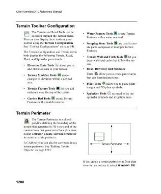
Terrain Perimeter
The Terrain Perimeter is a closed
polyline defining the boundary of the
terrain that generates in 3D views and of the
contour lines that generate in floor plan view.
Select Terrain> Create Terrain Perimeter
to create a terrain perimeter.
A CAD polyline can also be converted into a Terrain Perimeter
terrain perimeter. See “Editing Terrain
Objects” on page 1215.
If you create a terrain perimeter in floor plan
view but do not see it, select Window> Fill
1200