
Page 9 - Tuskegee Airmen Drone License Preparatory Course Chp.2 Manual
P. 9
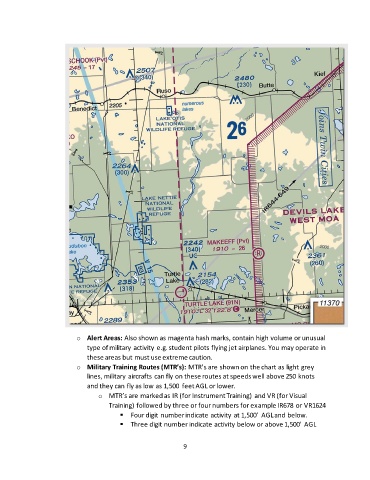
o  Alert Areas: Also shown as magenta hash marks, contain high volume or unusual
                              type of military activity e.g. student pilots flying jet airplanes. You may operate in
                              these areas but must use extreme caution.
                          o  Military Training Routes (MTR’s): MTR’s are shown on the chart as light grey
                              lines, military aircrafts can fly on these routes at speeds well above 250 knots
                              and they can fly as low as 1,500  feet AGL or lower.
                                  o  MTR’s are marked as IR (for Instrument Training) and VR (for Visual
                                     Training) followed by three or four numbers for example IR678 or VR1624
                                         ▪  Four digit number indicate activity at 1,500’  AGL and below.
                                         ▪  Three digit number indicate activity below or above 1,500’ AGL


                                                              9