
Page 19 - DPR Rishikesh Legacy_Neat
P. 19
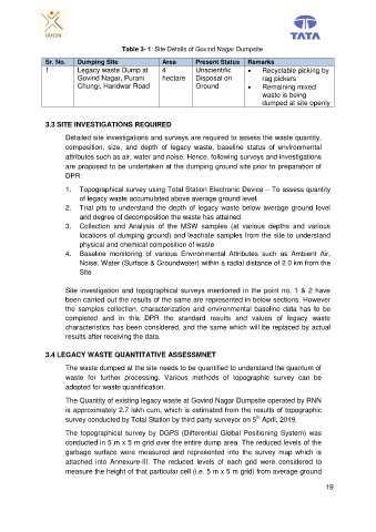
Table 3- 1: Site Details of Govind Nagar Dumpsite
Sr. No. Dumping Site Area Present Status Remarks
1 Legacy waste Dump at 4 Unscientific Recyclable picking by
Govind Nagar, Purani hectare Disposal on rag pickers
Chungi, Haridwar Road Ground Remaining mixed
waste is being
dumped at site openly
3.3 SITE INVESTIGATIONS REQUIRED
Detailed site investigations and surveys are required to assess the waste quantity,
composition, size, and depth of legacy waste, baseline status of environmental
attributes such as air, water and noise. Hence, following surveys and investigations
are proposed to be undertaken at the dumping ground site prior to preparation of
DPR:
1. Topographical survey using Total Station Electronic Device – To assess quantity
of legacy waste accumulated above average ground level.
2. Trial pits to understand the depth of legacy waste below average ground level
and degree of decomposition the waste has attained.
3. Collection and Analysis of the MSW samples (at various depths and various
locations of dumping ground) and leachate samples from the site to understand
physical and chemical composition of waste
4. Baseline monitoring of various Environmental Attributes such as Ambient Air,
Noise, Water (Surface & Groundwater) within a radial distance of 2.0 km from the
Site
Site investigation and topographical surveys mentioned in the point no. 1 & 2 have
been carried out the results of the same are represented in below sections. However
the samples collection, characterization and environmental baseline data has to be
completed and in this DPR the standard results and values of legacy waste
characteristics has been considered, and the same which will be replaced by actual
results after receiving the data.
3.4 LEGACY WASTE QUANTITATIVE ASSESSMNET
The waste dumped at the site needs to be quantified to understand the quantum of
waste for further processing. Various methods of topographic survey can be
adopted for waste quantification.
The Quantity of existing legacy waste at Govind Nagar Dumpsite operated by RNN
is approximately 2.7 lakh cum, which is estimated from the results of topographic
th
survey conducted by Total Station by third party surveyor on 5 April, 2019.
The topographical survey by DGPS (Differential Global Positioning System) was
conducted in 5 m x 5 m grid over the entire dump area. The reduced levels of the
garbage surface were measured and represented into the survey map which is
attached into Annexure-III. The reduced levels of each grid were considered to
measure the height of that particular cell (i.e. 5 m x 5 m grid) from average ground
19